3D PHOTOGRAMMETRY
What is Photogrammetry?
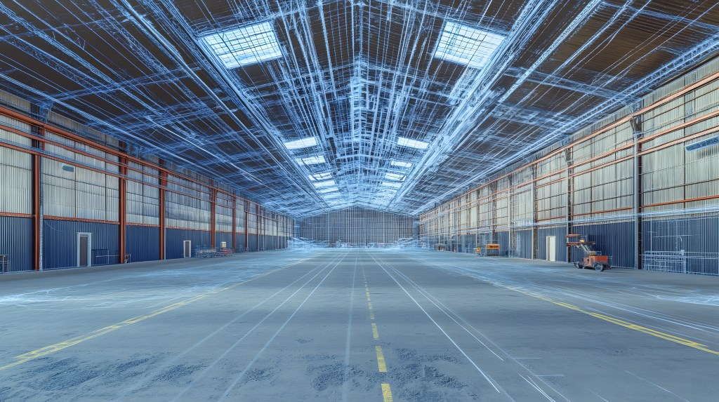
Photogrammetry is the process of capturing overlapping photographs from multiple angles to reconstruct accurate, measurable 3D models. At Core Capture, we use high-resolution imagery and advanced photogrammetry software to produce colorized point clouds, textured 3D meshes, and orthographic images that bring existing conditions to life.
This technique is ideal for visually rich, photo-realistic documentation of building exteriors, facades, and complex architectural features. It complements LiDAR scanning by enhancing context and communication with detailed, full-color visuals.
When Should Photogrammetry Be Used?
Photogrammetry is best suited for capturing:
- Building facades and elevations
- Detailed architectural features
- Hard-to-scan textures or materials
- Visual documentation for stakeholder review
- Historic or ornamental structures
How Photogrammetry Complements 3D Scanning
While LiDAR delivers millimeter-level geometric precision, photogrammetry adds a layer of visual fidelity. Together, they form a hybrid solution: laser scanning provides the structure, and photogrammetry overlays the texture. Core Capture uses both when clarity and accuracy are equally important—helping clients see not just where things are, but also what they look like.
How Accurate Is Photogrammetry?
Photogrammetry is highly accurate when performed in controlled conditions—typically within a few centimeters. For applications where visual documentation is the priority (such as facade modeling or historic preservation), it delivers excellent results. For tighter tolerances, Core Capture can integrate photogrammetry with LiDAR to ensure both visual and geometric precision.
What Deliverables Can I Expect?
With photogrammetry, we can deliver a range of valuable assets, including colorized point clouds, textured 3D meshes, orthophotos of facades and walls, and detailed 2D elevations and sections. These deliverables also provide visual references for design teams, helping to streamline the design process. All outputs are formatted to be compatible with common BIM and CAD platforms, and can be customized to meet the specific scope and standards of your project.
